8579 Scurfield Dr NW
Small Office · low-rise office building · built 1994 · 8579 Scurfield Dr NW
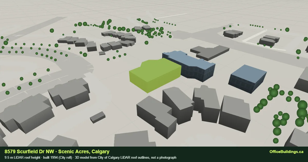
8579 Scurfield Dr NW is a 9.5 m low-rise office building in Scenic Acres, Calgary, recorded on the City assessment roll as built in 1994. Its main structure is the 528th tallest office roof of the 775 ranked in this record, and 3rd of 3 in Scenic Acres. The City assesses the parcel at $1.7M on the 2026 roll, 678th of 822 sites in the record by assessed value. The nearest CTrain platform is Crowfoot, 398 m away in a straight line. 172 scheduled transit trips call within 300 m of the parcel on a weekday. Since 2012 the City has recorded 5 building permits and 0 development permits on the parcel, the largest a $15,761 child care facility permit for repair, applied for in 2020.
- Civic address
- 8579 Scurfield Dr NW, Calgary, AB
- Community
- Scenic Acres (SCE)
- City sub-property use
- C102 Small Office · all Small Office sites
- Land use district
- C-N2 — Commercial - Neighbourhood 2 (Commercial)
- Height rank
- #528 of 785 citywide · #3 of 3 in Scenic Acres
- Footprint to parcel
- 31% of the parcel under LiDAR footprints
- Parcel pieces
- 1 titled piece · roll 173145905
- Coordinates
- 51.120703, -114.211558
Slav Loban and the Commercially × Real Broker team give Calgary commercial owners a confidential pricing opinion based on the public record shown on this page: assessment history, permits, land use and the surrounding market. It is a broker’s opinion of value, not a formal appraisal. You do not need to be ready to list to start the conversation.
Massing and site plan
Left: isometric massing of every LiDAR structure on the parcel, at true scale, viewed from the south-west with 3.9 m storey lines. Right: plan of the parcel with surrounding footprints, Plus 15 walkways and nearby stations. Open this building in the 3D city →
How it compares
Roof height against the Scenic Acres median and tallest, and against the city.
Access
Public-geometry tests only; confirm routes, entrances and hours with the building.
CTrain
Nearest station: Crowfoot, 398 m straight-line (route 201).
Plus 15
Outside the Plus 15 network area.
Cycling
The best-rated cycling facility within 400 m of the parcel is a community street (On-Street Bikeway), 89 m away.
Winter access
The parcel fronts a Priority 2 snow and ice clearing route, 10 m from its edge. Priority 2 routes are cleared after the Priority 1 network.
Accessible crossing
The nearest accessible pedestrian signal is at Scenic Acres Boulevard and Scurfield Drive, 138 m from the parcel. The closest signalised crossing, Scenic Cove Drive and Scurfield Drive at 53 m, has no accessible signal recorded.
Straight-line tests against The City of Calgary Calgary Bikeways, Snow and Ice Clearing Priority Routes and Traffic Signals, retrieved 2026-09-24. Bikeways are ranked by the City's comfort level, where 1 is a protected lane and 4 a major street. Snow priority is a clearing order, not a clearing time. An accessible pedestrian signal gives audible and tactile crossing cues; a signal recorded as unknown is not counted as having none.
Transit service
Scheduled Calgary Transit service at the door, not only the distance to a platform.
172 scheduled transit trips call within 300 m of this parcel on a representative weekday, 24 of them between 07:00 and 09:00, across 7 routes and 9 stops. The closest stop is SB Scurfield DR @ Scenic GD NW, 26 m away.
| Service class | Trips on the service day |
|---|---|
| REGULAR | 167 |
| SCHOOL | 5 |
Routes: 40 Crowfoot Station/North Hill · 97 South Ranchlands/Scenic Acres · 113 North Ranchlands/Scenic Acres · 120 Silver Springs · 813 St. Francis/Arbour Lk/ Scenic Acres/Silver Springs · 820 St. Francis/Scenic Acres North · 836 St. Vincent de Paul/ Scenic Acres.
Calgary Transit Scheduling Data (GTFS), service day 2026-09-28 inside the 2026-09-15 to 2026-12-20 service period. A trip is counted once however many stops it calls at inside the radius. Schedules change each service period; this is the schedule, not observed service.
Parking
What the City’s own tariff record says about kerbside parking beside this parcel.
Residential permit parking zone SCA. The centre of this parcel falls inside a City residential parking zone, so nearby residential streets are permit-restricted and are not available for all-day staff parking. Check the signs for the hours that apply.
No Active paid on-street parking zone lies within 200 m of this parcel in the City’s tariff dataset. That is not a statement that parking is unavailable: free, permit-only and off-street parking are not recorded in this source.
Assessment history
Assessed values are The City of Calgary’s taxation figures by roll year, not sale prices or rents; Alberta does not publish transaction prices.
Roll 173145905 · Small Office
Series not charted. The City’s published values for this roll number change by more than half or double between years, which usually signals a re-numbered, split or partially assessed account rather than a market movement. The published figures are listed below without a trend claim.
Published values by roll year
| Roll year | Assessed value | Change |
|---|---|---|
| 2005 | $1.5M | — |
| 2006 | $1.7M | 14.1% |
| 2007 | $2.5M | 49.4% |
| 2008 | $2.7M | 5.5% |
| 2009 | $3.0M | 12.3% |
| 2010 | $465,500 | -84.5% |
| 2011 | $345,500 | -25.8% |
| 2012 | $402,000 | 16.4% |
| 2013 | $451,000 | 12.2% |
| 2014 | $493,000 | 9.3% |
| 2015 | $557,500 | 13.1% |
| 2016 | $568,500 | 2.0% |
| 2017 | $453,500 | -20.2% |
| 2018 | $415,500 | -8.4% |
| 2019 | $331,500 | -20.2% |
| 2020 | $490,000 | 47.8% |
| 2021 | $300,000 | -38.8% |
| 2022 | $283,500 | -5.5% |
| 2023 | $336,500 | 18.7% |
| 2024 | $1.6M | 360.6% |
| 2025 | $1.4M | -6.5% |
| 2026 | $1.7M | 16.6% |
Development and building permits
Applications the City has located on this parcel since 2012, from the Development Permits and Building Permits datasets.
Recent development permits 0 since 2012
None located on this parcel since 2012.
Recent building permits 5 since 2012 · 0 in the City’s office class
| Applied | Permit | Class · work | Est. cost | Status |
|---|---|---|---|---|
| 2023-06-14 | BP2023-09258 | 5301 - Child Care Facility · Alteration Interior Alteration | $3,000 | Completed |
| 2021-08-18 | BP2021-14504 | 5301 - Child Care Facility · Fire/ Security Alarm Cancare Children's Centre- fire alarm upgrade | $3,000 | Completed |
| 2020-03-23 | BP2020-03462 | 5301 - Child Care Facility · Repair Repair After Vehicle Impact - Group A2 - Cancare Child Centre | $15,761 | Completed |
| 2016-11-04 | BP2016-13762 | 5117 - Commercial School · Alteration SKC (Shotokan Karate Club) Calgary | $15,000 | Completed |
| 2016-03-22 | BP2016-02530 | 5301 - Child Care Facility · Alteration Camcare Children's Centre Reno | — | Cancelled |
Declared estimated project cost across all 5 non-residential building permits on the parcel since 2012: $36,761. Permit descriptions are the City’s records at retrieval; applicant and contractor names are not reproduced.
Inspections
What City inspectors recorded against the permits on this parcel.
6 inspection results are published against 4 of the 5 building permits on this parcel, from 2017-01-10 to 2024-04-12.
What was inspected
Result of each visit
| Outcome | Inspections |
|---|---|
| Acceptable | 5 |
| Not Acceptable | 1 |
Stage
| Inspection type | Count |
|---|---|
| Final | 4 |
| Progress | 2 |
The 6 most recent inspection results
| Date | Permit | Stage | Checklist | Outcome | Inspector note |
|---|---|---|---|---|---|
| 2024-04-12 | BP2023-09258 | Progress | Directives | Acceptable | No Infractions Noted. No Further BLDG Inspections Required |
| 2024-04-12 | BP2023-09258 | Final | Directives | Acceptable | No Infractions Noted. No Further BLDG Inspections Required |
| 2021-09-02 | BP2021-14504 | Final | General | Acceptable | Acceptable, no further inspections required. - Received fire alarm VI. Close file. |
| 2021-06-18 | BP2020-03462 | Final | General | Acceptable | - Structural repair report provided by Ben Ezenta, P. Eng. Senior Project Engineer. Work is complete as per CRISTIAN BAISCHE FIRST GENERAL SERVICES phone conversation. |
| 2021-06-18 | BP2020-03462 | Final | No access | Acceptable | — |
| 2017-01-10 | BP2016-02530 | Progress | DIRECTIVES | Not Acceptable | Book an inspection at your earliest convince. |
An inspection result is a record of one visit, not a verdict on the building. 1 of these 6 results are recorded as Not Acceptable. In the City's process a Not Acceptable result is an ordinary step: the inspector lists what must change and the work is re-inspected, which is why the most common outcome across the record is Acceptable Add Inspection. Most results relate to a single tenant improvement rather than the whole building. Inspector notes are The City of Calgary's own text at retrieval, with contact details removed; applicant and contractor names are never read.
The City of Calgary Building Inspections Results, joined to building permits by permit number, retrieved 2026-09-24.
Occupiers and licensed businesses
The public record of who operates on the parcel, labelled by source.
Businesses licensed by the City on this parcel 0 as of 2026-09-24
No City of Calgary business licence is recorded at this address or inside this parcel.
Not a tenant roster. The City licenses specific business types (retail, food service, personal services, contractors, wholesalers, schools and similar). Most office occupiers such as professional firms need no municipal licence and do not appear here. Matched by civic address and by licence location inside the parcel; home-based licences are excluded.
No individuals are named. The City issues many personal-service licences to people trading under their own name. Suite numbers are never published, and where a licence reads as an individual rather than an organisation the name is withheld and only the licence category is shown. Names of sources this site does not use are omitted.
Nearby office buildings
The six nearest office building sites in the record, by straight-line distance between parcel centroids.
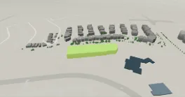
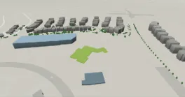
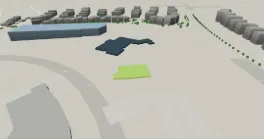
Where this building sits in the record
Every collection this building belongs to, from the same public data shown above.
8579 Scurfield Dr NW questions
Answers drawn from the record.
How tall is 8579 Scurfield Dr NW?
The main structure on the parcel has a LiDAR roof height of 9.5 m in The City of Calgary’s 3D building data, a storey-equivalent of about 2 at 3.9 m per storey.
When was 8579 Scurfield Dr NW built?
The City’s assessment roll records 1994 as the year of construction.
What is the assessed value of 8579 Scurfield Dr NW?
The City of Calgary assesses this parcel at $1.7M in total on the 2026 roll, 678th of 822 sites in this record. Assessed value is the City’s figure for property tax, not a sale price or an asking price.
What is 8579 Scurfield Dr NW zoned?
The parcel is designated C-N2, Commercial - Neighbourhood 2, under the City of Calgary Land Use Bylaw. Confirm the designation and any amendments with the City before relying on it.
Which CTrain station is closest to 8579 Scurfield Dr NW?
Crowfoot Station, 398 m in a straight line from the parcel centroid.
Who is in 8579 Scurfield Dr NW?
No City of Calgary business licence is recorded at this address or inside the parcel. Most office occupiers such as professional firms do not need a municipal licence, so the register is not a tenant roster.
Has 8579 Scurfield Dr NW been inspected?
The City publishes 6 inspection results against 4 permits here, between 2017-01-10 and 2024-04-12. Each result records one visit and most relate to a single tenant improvement, so this is not a verdict on the building.
How good is transit at 8579 Scurfield Dr NW?
172 scheduled transit trips call within 300 m of the parcel on a representative weekday, 24 of them in the morning peak, across 7 routes. The closest stop is SB Scurfield DR @ Scenic GD NW, 26 m away. That is the published schedule for one service period, not observed service, and it counts each trip once however many stops it makes nearby.
Can staff cycle or get there in winter at 8579 Scurfield Dr NW?
The best-rated cycling facility within 400 m is a community street, 89 m away. The parcel fronts a Priority 2 snow and ice clearing route. It sits inside residential permit parking zone SCA, so nearby residential streets are not available for all-day parking. These are straight-line tests against City layers.
Where can visitors park at 8579 Scurfield Dr NW?
No Active paid on-street parking zone lies within 200 m of this parcel in the City's tariff dataset. Free, permit-only and off-street parking are not recorded in that source, so this is not a statement that parking is unavailable.
Is office space available at 8579 Scurfield Dr NW?
This profile is built from public records and does not track availability, rents or tenancy. Submit a private requirement and current options in the building or nearby will be confirmed through Commercially.
Public record sources: Current Year Property Assessments (Parcel), Historical Property Assessments (Parcel), Assessment Subproperty Use Codes, 3D Buildings - Citywide (LiDAR roof outlines), Land Use Districts, Transit LRT Stations, Green Line Stations, Plus 15, Historic Resource (Inventory of Evaluated Historic Resources), Development Permits, Building Permits, Calgary Existing Buildings - Performance Metrics (BenchmarkYYC), Calgary Business Licenses, On-Street Parking Zones with Rates, Building Inspections Results, Residential Parking Zones, Snow and Ice Clearing Priority Routes, Traffic Signals, Calgary Bikeways — The City of Calgary, retrieved 2026-09-24. Contains information licensed under the Open Government Licence – City of Calgary. Building names, floor counts and architects, where shown, come from Wikidata (CC0). No brokerage, listing-data or commercial research source is used.
Boundary: Assessed values are the City’s assessment-roll figures for taxation and are not sale prices, asking rents, vacancy or availability; Alberta does not publish transaction prices. LiDAR heights are roof-surface elevations above the lowest ground point at the building perimeter and can differ from architectural heights. Storey equivalents are derived at 3.9 m per storey and are not floor counts. Distances are straight-line. Permit descriptions are the City’s records at retrieval and do not establish current use, tenancy or availability. Read the methodology.